by Jane Cassie
 How do time-deprived couples manage to stay blissfully connected these days? While juggling jobs, kids and homestead, who has the energy to keep love alive and sparks flying? Desperate for a pulse-quickening gift, and one that’s far from daily demands, I quickly Google ‘romantic places.’ In a jiffy my electronic genie comes to the rescue! San Francisco, a short flight from Vancouver, is listed as one of the top spots to smooch.
It’s also the place where crooning singer, Tony Bennett, once left his heart. Surely during a three day stint of Valentining, we’ll be able to unite ours!
I refine the search to discover that this peninsular enclave, that’s rimmed on three sides by shimmering waves, is bursting with tantalizing opportunities.
We could mosey around tourist haunts like Fisherman’s Wharf where we’d dine on Dungeness crab, then stroll Ghirardelli Square to sample my favorite aphrodisiac –chocolate.
Cuddling on a cable car, sauntering along a stretch of sand and caressing on a harbour cruise –they’re all ‘amoré must dos.’ Many of the popular tourist icons are included in the City Pass, a coupon book that’ll give us a great bang for our buck. By supplementing it with a few of these other intimate ideas, I’ll surely spoil my sweetheart!
Flying high
We get a real lift while flight-seeing, heli-style. San Francisco Helicopters have been offering whirly bird tours since 1976 and as well as sweeping us off our feet they’ll give us a panoramic city view in just thirty minutes!
We’ll peer down at Alcatraz, the infamous island prison where mobsters like Al Capone did time, fly above (and under!) the Golden Gate Bridge that spans the glistening bay, and glide above skyscrapers that frame this dreamy city.
We get some real live action
As well as offering more than twenty museums to appease our cultural desires there’s one particular live performance that would even tweak Aphrodite’s interest. Beach Blanket Babylon, the longest running musical revue in theatre history, is a wild and wacky parody on American pop culture.
It features outrageous entertainers who are decked out in flamboyant costumes, massive hats and big hair. Some mimic famous actors and not so popular politicians, others try to help Snow White find her true love. All four hundred seats in the cabaret style, Club Fugazio, offer a good view, but I’ll need to book early as most shows sell out.
Hand holding hills
 There’ll be lots of palm to palm and heavy breathing going on when we tackle a few of San Francisco’s slopes!
From Russian Hill, we can traipse down Lombard, a hairpin street that’s rated as one of the most crooked in the world. A plod up Nob Hill will take us past elite apartment buildings and luxury condos where the wealthy hang out. And on Telegraph Hill we can take in the sunset from the Coit Tower.
This beacon not only commemorates San Francisco’s volunteer fire department but also dubs as a romantic lookout, whatever time of day.
Cozy Nooks and Neighborhood
San Francisco is dotted with uniquely flavored neighborhoods and each one sports its own personality and allure.
 Chinatown, clad in festive colours, offers everything from decorative dragons to delicious dim sum. A short stroll away is the square mile of North Beach where tantalizing Italian coffeehouses, bars and bakeries dish up delicacies, Bohemian style, and if shopping turns us on, Union Square is the place to roam.
We can check out an award-winning film in the Castro area, head to Alamo Square where the city backdrop and rows of pink ladies (Victorian homes) will provide a great photo memento, and most definitely meander through the famous Haight-Ashbury district.
After all it is the original home to flower power, ‘be-ins’ and free love.
About the author:
This week Traveling Tales welcomes the freelance travel writer/photographer team of Jane and Brent Cassie, who live in South Surrey, a suburb of Vancouver B.C..
Photos by Brent Cassie:
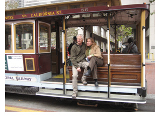
1: Enjoying a cuddle aboard one of the city’s cable cars.
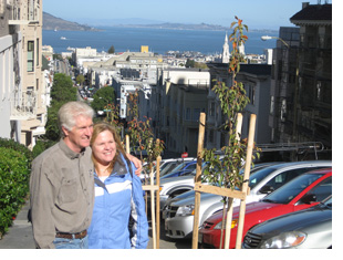
2: Jane and Brent on one of the city’s hand-holding hills.
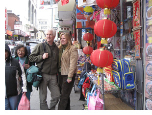
3: Chinatown is alive with festive colour.
Where to stay:
Hyatt Regency San Francisco
5 Embarcadero Center,
San Francisco, California, USA 94111
Tel: +1 415 788 1234 Fax: +1 415 398 2567
www.sanfranciscoregency.hyatt.com
What to do:
City Pass: www.gosanfranciscocard.com/
Beach Blanket Babylon: www.beachblanketbabylon.com/
San Francisco Helicopter Tours: www.sfhelicoptertours.com/
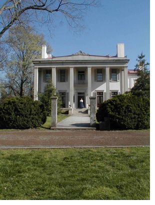 Even thought she is pretty hard to top, some of the flesh and blood women have left a larger than life legacy. Take the nineteen-year-old Selene Harding of Belle Meade Plantation. She was the ultimate cheerleader.
 Kitty Wells, first woman to be elected to the Grand Ole Opry and Lula Naff who managed the Ryman Auditorium for fifty years and is credited with collecting the autographed photos, playbills and programs of those who preformed there over the years.
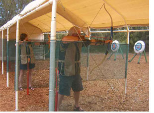 Such hunters may drive, as we do, through a grove of ironwood trees to Lana’i Pine Sporting Clays to hone their prowess. After initial lessons on laser-guided pellet rifles, we’re plinking targets. Next knocking fleches and drawing bowstrings, we plunk arrows around bulls-eyes.
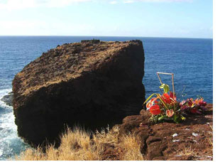 Early the next day we hike along Hulopo’e beach and up a well-worn trail through jagged black lava to visit Sweetheart Rock. Romantic souls had placed a beautiful floral tribute at a cliffside spot overlooking this legendary sea stack topped with a rock tomb.
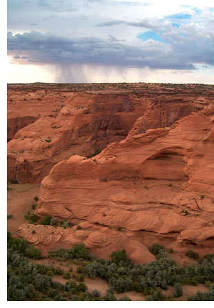 The canyon walls are sheer and sculpted from a subtle palette of sandstone, ranging from a dramatic red to a pale beige with a rosy tint. The scale of the canyon tricks the eye.
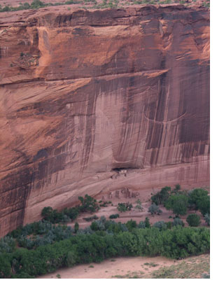 Now our path is level, cutting past an orchard of gnarled old trees, over rock outcroppings and even through a short tunnel cut through the rock. We come out through the trees to a plain dotted with trees and stretching a few thousand feet to the sheer rock face.
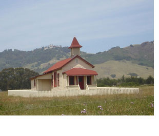
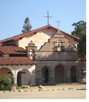 On the inland side of the majestic Santa Lucia Mountains, between the Hearst Castle and US Highway 101, lies a beautiful valley and mission. Mission San Antonio de Padua, the third mission established in the California system, also has historic Hearst connections.
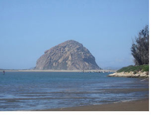 Another one of Highway One’s world-renowned locations is Morro Rock, easily found on the outskirts of Morro Bay. Peregrine Falcons, considered endangered species, nest on the top and only the Chumash Indians are allowed to climb, on occasion, for ceremonial purposes.
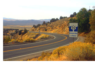
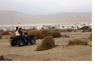 Just an hour down Hwy 50, I discovered Sand Mountain, formed about 4,000 years ago, it towers about 600 feet and attracts sandboarders and ATVers from all over. Adjourning this natural phenomenon is one of the best-preserved Pony Express station houses in Nevada, Sand Springs.
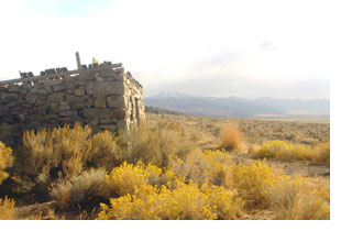 Many other stone structures dot the landscape along Highway 50. These ruins are what remains of tiny hamlets that once dotted the landscape during the mining booms.
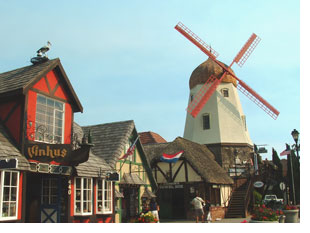
 Handcrafted leather goods of Viking/Celtic design are for sale along with Viking bead jewelry at the Viking Traders Tables. I’m going to look for something to set off my eyes. I also intend to take the opportunity to observe demonstrations of weaving, sewing, and cooking and hear about herbal lore done in the context of the ancient peoples of the Nordic/Germanic ancestry.
 In the early afternoon, people will starting to line up along the sides of Mission Drive in anticipation of the Danish Days Parade. The parade last year was made up of the usual components of marching bands and local officials.
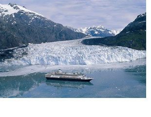
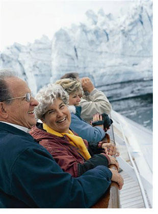 I am glad for his sharp wits, for despite the day’s bright sunshine, I have no inclination to go swimming. Fall overboard in this water, its temperature hovering at the freezing point, and hypothermia would kill you within two-to-four minutes. “The lifejackets are only there to help identify and locate the bodies,” a passenger quips.
 The courtship worked, and the arrival of the ships brought a revival to Skagway, with new stores and an influx of 1,800 new summer workers to man the tourism boom. “We went from economic depression to having the highest income in the state,” Buckwheat says.
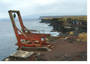 Near these wooden platforms, azure-blue seawaters surge up the sides of a puka in the lava…and gently recede. With meticulous timing, divers leap into this deep hole, ride through the lava tube into open ocean…climbing back up the cliff on rusty ladders…
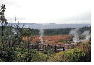 Billowing volcanic gasses seep from the ground, enshrouding treeless landscapes and depositing acid-yellow crystals on surrounding rocks. Returning atop the crater’s rim, countless steamy vents cloak purple-pink orchids and vegetation with a swirling, ghostly mystique.
 Pointing northward to Kahekili Beach Park, she continued, “Warriors trained there…and Hawaiians launched their koa-wood canoes to visit Lanai.” Also nicknamed Airport Beach, old airstrip fragments remain off in the bushes. “The terminal’s Windsock Bar was well-known by travelers between 1960 and 1987 for great Bloody Marys,” Keli’i winked.
 Back at Banyan Park’s southwest corner, fort remnants from 1831 endure, originally built after raucous sailors lobbed cannonballs into town, disputing with missionaries over Hawaiian women visiting their ships. Demolished twenty years later, hand-cut coral blocks from its 20-foot-high walls built the jail standing at Prison and Waine’e Streets.